


EMERALD - T 2 Voting District, St. Croix County, Wisconsin
About
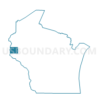
Outline

Summary
| Unique Area Identifier | 696864 |
| Name | EMERALD - T 2 Voting District |
| County | St. Croix County |
| State | Wisconsin |
| Area (square miles) | 5.98 |
| Land Area (square miles) | 5.98 |
| Water Area (square miles) | 0.00 |
| % of Land Area | 100.00 |
| % of Water Area | 0.00 |
| Latitude of the Internal Point | 45.05450050 |
| Longtitude of the Internal Point | -92.27819590 |
Maps


Graphs
Select a template below for downloading or customizing gragh for EMERALD - T 2 Voting District, St. Croix County, Wisconsin


Neighbors
Neighoring Voting District (by Name) Neighboring Voting District on the Map
- BALDWIN - T 1 Voting District, St. Croix County, WI
- EMERALD - T 1 Voting District, St. Croix County, WI
- GLENWOOD - T 1 Voting District, St. Croix County, WI
- SPRINGFIELD - T 1 Voting District, St. Croix County, WI
Top 10 Neighboring County Subdivision (by Population) Neighboring County Subdivision on the Map
- Springfield town, St. Croix County, WI (932)
- Baldwin town, St. Croix County, WI (928)
- Emerald town, St. Croix County, WI (853)
- Glenwood town, St. Croix County, WI (785)